
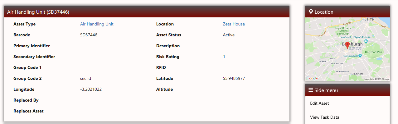
Where assets in ZetaSafe have been added and the Latitude and Longitude information for their precise location has been recorded, viewing the asset on the web will now display the assets location using Google Maps, clicking on the map will open the Google Maps software.
This function enables new technicians to hit the ground running allowing the user to seamlessly move between ZetaSafe and the Google mapping & direction tools.
Where no data has been provided no map will be displayed, note that Google will accept anything as input so the results might be unusual if they are incorrect!
Comments
0 comments
Article is closed for comments.